NOAA this week confirmed March 2026 was the hottest March on record for the Lower 48 states by the largest single-month departure from historical norms ever measured in US climate history. Every federal region recorded simultaneously unprecedented temperatures. A Super El Niño is now forming…
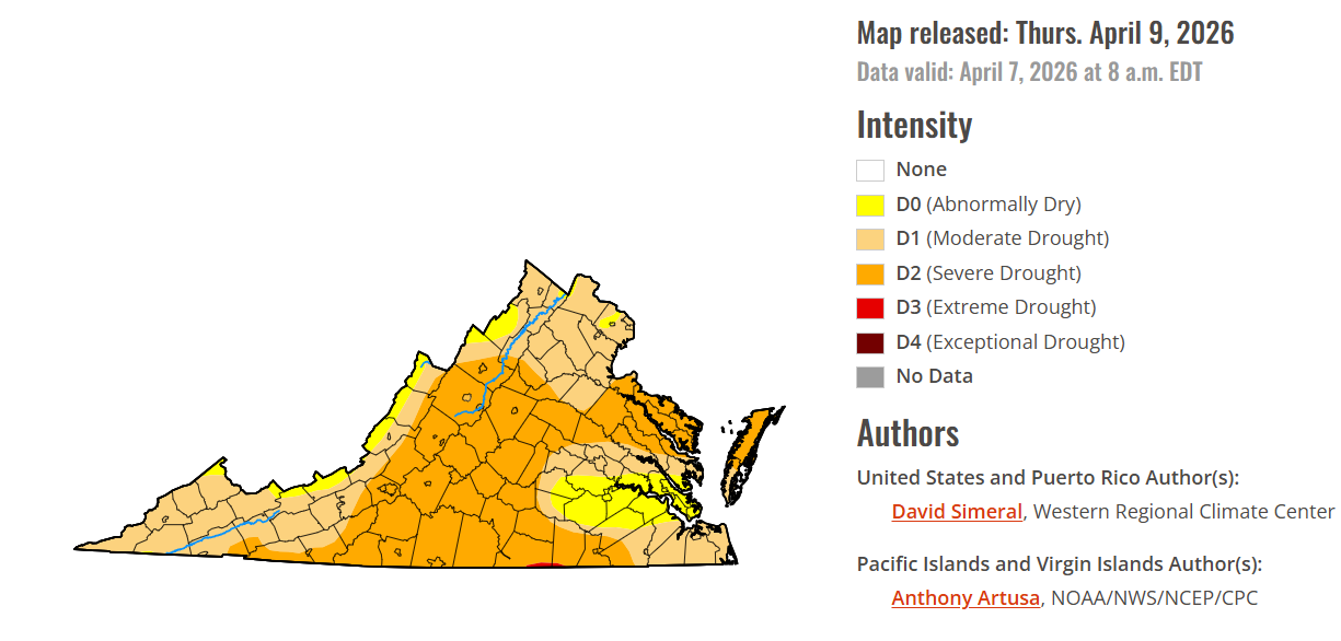
Most of the localities in the Roanoke Valley, central and Southside Virginia are under severe drought conditions with 24 of them, including Franklin County, this week receiving drought disaster designations from the United States Department of Agriculture.
The most recent U.S. Drought Monitor map for Virginia shows the Roanoke Valley, and much of central Virginia and Southside Virginia in severe drought conditions.
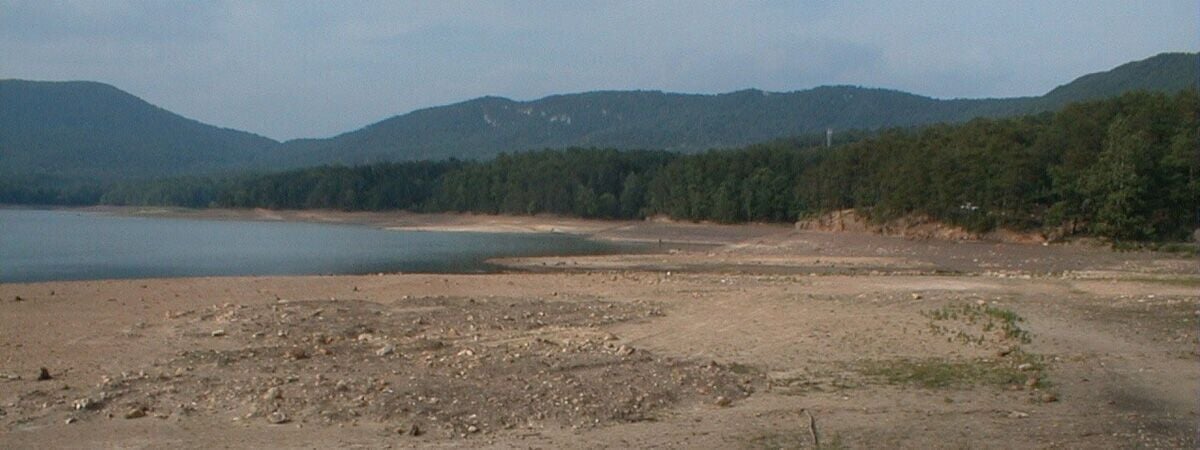
This is how Carvins Cove, one of the Roanoke Valley's primary water sources, appeared around the peak of the 2002 drought, when the water level reached 23.4 feet below full pond. Currently, it's 9 feet below full pond, still well below the average of 1.9 feet below for April.
The most recent U.S. Drought Monitor map for Virginia shows the Roanoke Valley, and much of central Virginia and Southside Virginia in severe drought conditions.
This is how Carvins Cove, one of the Roanoke Valley's primary water sources, appeared around the peak of the 2002 drought, when the water level reached 23.4 feet below full pond. Currently, it's 9 feet below full pond, still well below the average of 1.9 feet below for April.